Utilising drones for surveying Japanese knotweed offers numerous advantages:
- Aerial Perspective: Enhanced visibility for identifying infestations
- Efficiency: Quick coverage of large areas
- Access: Easily reach hard-to-access terrains
- High-Resolution Imagery: Detailed mapping and identification
- Minimal Disturbance: Less impact on sensitive environments
- Documentation: Clear evidence for stakeholder reports
- Regulatory Compliance: Meet requirements for invasive species management

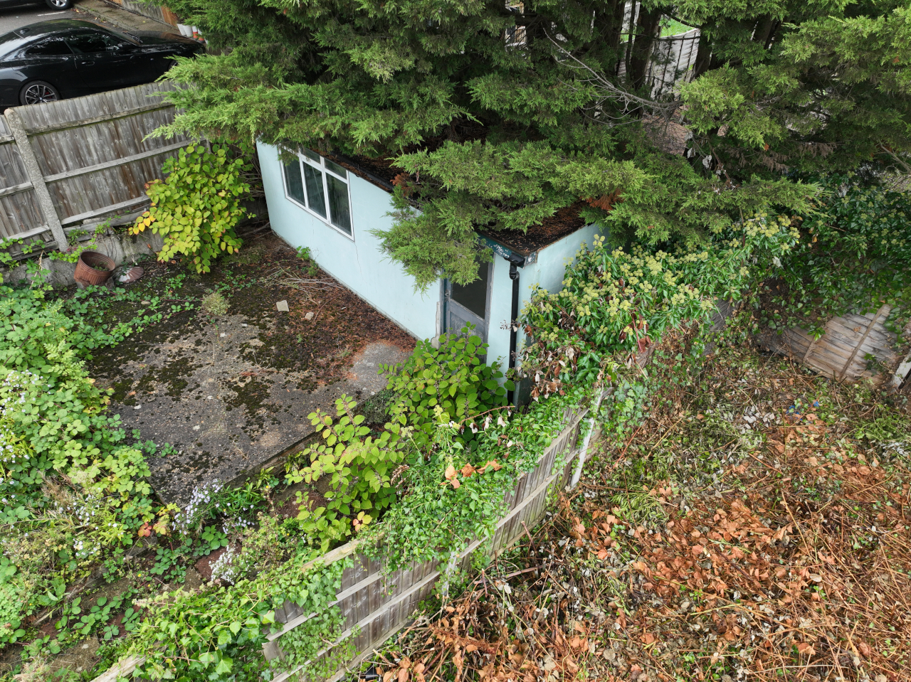
Take a good look at this photo. Then consider we were stood approximately 12m from where this picture was taken.
The client is looking to develop neighbouring land which has Japanese Knotweed present, but we didn’t understand if any neighbouring areas also had an issue.
A conventional foot survey may have overlooked this area, potentially complicating future development plans. But the considerable value of drone surveys is that we can reach the parts that conventional surveys cannot reach!
By identifying Japanese knotweed at this early stage, we can propose solutions that address surrounding issues, ensuring that development can proceed without unexpected invasive weed complications.
Drones enhance the efficiency, accuracy, and safety of knotweed surveys, making them an invaluable tool for surveyors!
For all Invasive Weed and Japanese Knotweed issues – whether you need a drone survey or not – get in touch and we will be happy to conduct a knotweed survey for you.
And while we’re on the subject… check out some of our drone footage of a survey we completed last year, here.
